Opening hours and admission for this place have not been checked yet, so none are shown. Check the official site
Our guide
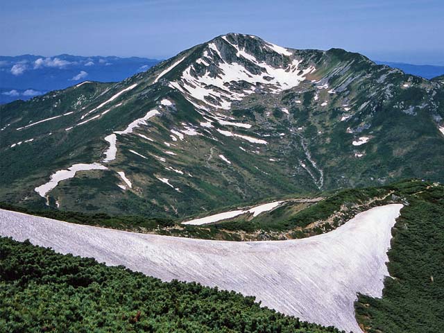
Mount Kurobegorō, 2,839.58 m, is a peak of the Hida Mountains on the border of Gifu and Toyama and one of the 100 Famous Japanese Mountains. It became part of Chūbu-Sangaku National Park on 4 December 1934.
This is high mountain country. We have not checked routes, huts or conditions, so check local information and the weather before you go.
Written by japan-spots.com (2026-09-22) from the sources credited on this page. Distances are straight lines between map positions.
Photos
Photos from Wikimedia Commons, each under its own licence — see credits
- Kurobegoro1 — Inti-sol · CC BY-SA 3.0 · source · resized
- Kurobegoroudake from suisyoudake 1994-8-13 — Alpsdake · Public domain · source · resized
- Kurobegorogoya — Yasu ( talk ) · CC BY-SA 3.0 · source · resized
- Hida Mountains from Mount Kurai 2005-03-21 — Alpsdake · CC0 · source · resized
What this place is
Mount Kurobegorō (黒部五郎岳, Kurobegorō-dake) is one of the 100 Famous Japanese Mountains, reaching the height of 2,839.58 m (9,316 ft). It is situated in Japan's Hida Mountains in Gifu Prefecture and Toyama Prefecture. It was specified for Chūbu-Sangaku National Park on December 4, 1934.
Background text from Wikipedia (CC BY-SA 4.0)
What to expect at this type of place: Mountain
Getting there
We do not have step-by-step transit directions for this spot yet. Open the location on Google Maps for routes from where you are staying.
Traveler reviews
No reviews yet — be the first to share how it went.