Opening hours and admission for this place have not been checked yet, so none are shown. Check the official site
Our guide
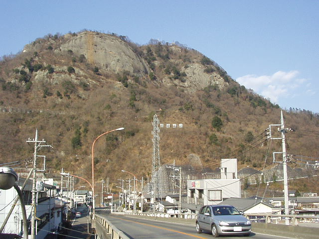
Iwadono Castle was a mountain castle in what is now Ōtsuki, Yamanashi, active in the Sengoku period as a strategic outpost of the Takeda clan of Kai Province. It is now in ruins but remains popular with hikers and people interested in history.
Ōtsuki Station on the Chūō Main Line is about 1.1 km away in a straight line, and Saruhashi Bridge about 2.8 km. It is a mountain site; we have not checked the trail, so look for local information before you go.
Written by japan-spots.com (2026-09-22) from the sources credited on this page. Distances are straight lines between map positions.
Photos
Photos from Wikimedia Commons, each under its own licence — see credits
- IwadonoYama2004 — Kinori · Public domain · source · resized
- 稚児落とし — Koda6029 · CC BY-SA 4.0 · source · resized
- 岩殿山から富士山を望む — Koda6029 · CC BY-SA 4.0 · source · resized
- Otsuki Station-4 — 江戸村のとくぞう · CC BY-SA 4.0 · source · resized
- 岩殿山城三の丸からの眺望 - panoramio — HOSTで巡査部長(硫黄島観賞) · CC BY 3.0 · source · resized
- IwadonoCastle-ViewOfOtsukiCity — Bryanmackinnon · CC BY 4.0 · source · resized
- IwadonoCastle-FureaiCommunityCenter — Bryanmackinnon · CC BY 4.0 · source · resized
- 岩殿山の鎖場 — Koda6029 · CC BY-SA 4.0 · source · resized
- IwadonoCastle-MountainPeakFromBelow — Bryanmackinnon · CC BY 4.0 · source · resized
What this place is
Iwadono Castle (岩殿城, Iwadono-jō) was a yamajiro located in present-day Ōtsuki, Yamanashi Prefecture, Japan. The castle was active during the Sengoku period and served as a strategic outpost of the Takeda clan of Kai Province. Though now in ruins, it remains a popular destination for hikers and history enthusiasts.
Background text from Wikipedia (CC BY-SA 4.0)
What to expect at this type of place: Castle
Nearby station
Nearby station: Ōtsuki (Chūō Main Line), about 1.1 km from the spot in a straight line.
Worked out on 2026-09-14 from this place’s map position, using HeartRails Express station data and station names from Wikidata. The distance is a straight line, not a walking route, and says nothing about buses, transfers or timetables — plan the trip on Google Maps.
Traveler reviews
No reviews yet — be the first to share how it went.