Noto Hantō Quasi-National Park
能登半島国定公園
Opening hours and admission for this place have not been checked yet, so none are shown. Check the official site
Our guide
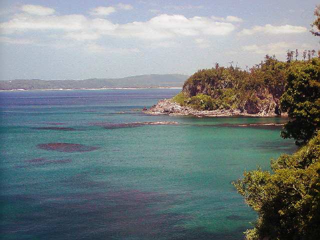
Noto Hantō Quasi-National Park covers much of the coast of the Noto Peninsula, which reaches about 100 km into the Sea of Japan from the northern half of Ishikawa, with one side facing Toyama Bay and the other the Sea of Japan. The peninsula is known for its coastal scenery and rural atmosphere, and the park spans nine municipalities in Ishikawa, among them Nanao, Suzu, Wajima and Hakui, and Toyama and Himi in Toyama; Mitsukejima is one of its well-known sights. Like all quasi-national parks, it is managed by the prefectures.
The park is spread along a long coast, so choose the area you want to visit and check current local information before you go; we have not checked routes.
Written by japan-spots.com (2026-09-22) from the sources credited on this page. Distances are straight lines between map positions.
Photos
Photos from Wikimedia Commons, each under its own licence — see credits
- Sotoura — Akimoto · CC BY-SA 3.0 · source · resized
- 雨晴海岸(女岩・立山連峰)20250215-IMG 2902 — くろふね · CC BY 4.0 · source · resized
- Wakura Onsen Kagaya 200906-2 — Totti · CC BY-SA 4.0 · source · resized
- Tsukumo Bay Promenade ac — Asturio Cantabrio · CC BY-SA 4.0 · source · resized
- Rokkosaki Lighthouse 1 — photo: Qurren ( talk ) Taken with Sony Cyber-shot DSC-U20 · CC BY-SA 3.0 · source · resized
- Mitsukejima (Ishikawa) 2 — photo: Qurren ( talk ) Taken with Canon IXY 430F (Digital IXUS 245 HS) · CC BY-SA 3.0 · source · resized
- Godzilla-iwa — 名古屋太郎 · CC BY-SA 3.0 · source · resized
- Chirihama nagisa driveway — Kwekwe · CC BY-SA 3.0 · source · resized
- NotoCoast — Fg2 (uploader on Commons) · Public domain · source · resized
- Notojima — Takashi OTA · CC BY 2.5 · source · resized
What this place is
Noto Hantō Quasi-National Park (能登半島国定公園, Noto-hantō Kokutei Kōen) is a quasi-national park covering a portion of Noto Peninsula of Ishikawa Prefecture and Toyama Prefecture in Japan. It is rated a protected landscape (category V) according to the IUCN. Noto Peninsula (能登半島, Noto Hantō) in the northern half of Ishikawa Prefecture, extends about 100 kilometers into the Sea of Japan. The peninsula is known for its coastal scenery and rural atmosphere. The Quasi-National Park covers much of the coastline, one side of which faces Toyama Bay and other side of which faces the Sea of Japan. The borders of the park span the municipalities of Nanao, Suzu, Wajima, Hakui, Anamizu, Noto, Shika, Hōdatsushimizu and Nakanoto in Ishikawa Prefecture and Toyama and Himi in Toyama Prefecture. Like all Quasi-National Parks of Japan, Noto Hantō Quasi-National Park is managed by the local prefectural governments.
Background text from Wikipedia (CC BY-SA 4.0)
What to expect at this type of place: National park
Getting there
We do not have step-by-step transit directions for this spot yet. Open the location on Google Maps for routes from where you are staying.
Traveler reviews
No reviews yet — be the first to share how it went.