Opening hours and admission for this place have not been checked yet, so none are shown. Check the official site
Our guide
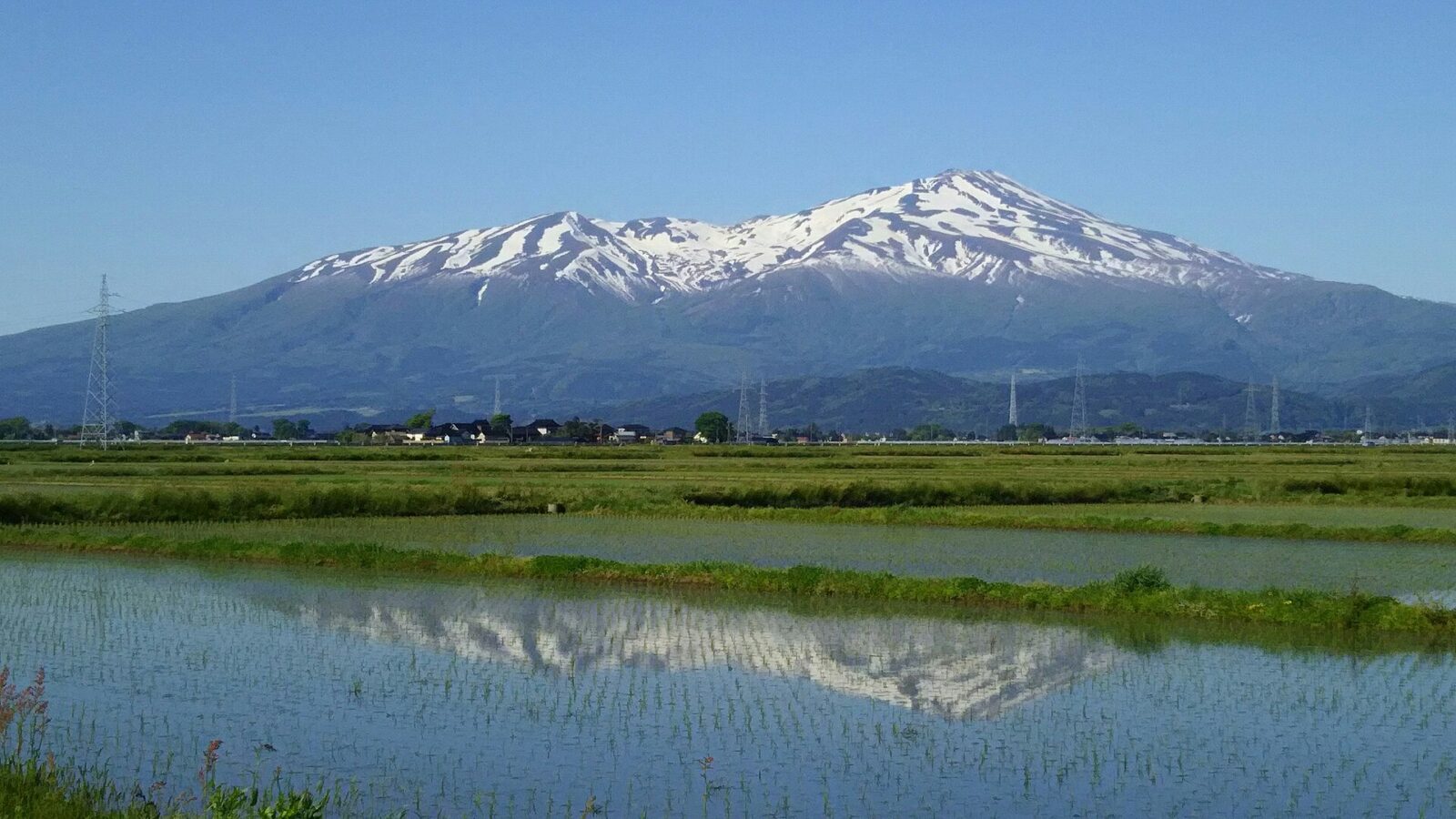
Mount Chōkai is an active volcano, 2,236 m high, on the border of Akita and Yamagata. Its roughly symmetrical shape and great bulk have earned it several local names — Dewa Fuji, Akita Fuji or Shōnai Fuji, depending on where you see it from. It is one of the 100 Famous Japanese Mountains and one of the 100 Famous Landscapes of Japan, lies within Chōkai Quasi-National Park, and is a National Historic Site. Followers of Shugendō regard it as sacred, and the Chōkaisan Ōmonoimi Shrine is on the mountain. It is popular with hikers.
We have not checked trails, seasons or a route to the mountain, so plan the journey on the map and look for local information before you go.
Written by japan-spots.com (2026-09-22) from the sources credited on this page. Distances are straight lines between map positions.
Photos
Photos from Wikimedia Commons, each under its own licence — see credits
- Mount Chōkai (2017-05-19) - Flickr — kyohei ito · CC BY-SA 2.0 · source · resized
- 七高山から新山の眺め — Koda6029 · CC BY-SA 4.0 · source · resized
- Ridge of the Mt. Chokai — 8-Forest · CC BY-SA 3.0 · source · resized
- Niigata from Bandaijima Building 20200906 P6 — 皓月旗 · CC BY-SA 4.0 · source · resized
- Mt. Chokai over rice fields — Douglas P. Perkins · CC BY-SA 3.0 · source · resized
- Mt.Chokai Summer — ChiefHira · CC BY-SA 3.0 · source · resized
- Mount Chōkai — Qwert1234 · CC BY-SA 3.0 · source · resized
- Mount Chokai (19498923290) — yari hotaka · CC BY 2.0 · source · resized
- Lake Chokai, 19 Oct. 2013 — 8-Forest · CC BY-SA 3.0 · source · resized
- From Mount Chokai (6185584662) — Jun K · CC BY-SA 2.0 · source · resized
What this place is
Mount Chōkai (鳥海山, Chōkai-san or Chōkai-zan) is an active volcano located on the border of Akita and Yamagata in the Tōhoku region of Japan, and is 2,236 m (7,336 ft) tall. Because of its (roughly) symmetrical shape and massive size, it is also variously known as Dewa Fuji (出羽富士), Akita Fuji (秋田富士) or Shōnai Fuji (庄内富士) depending on the location of the viewer. In addition to being one of the 100 Famous Landscapes of Japan, it is also included as one of the 100 famous mountains in Japan, and famous 100 Geographical Features of Japan. It is surrounded by Chōkai Quasi-National Park. It is also a National Historic Site of Japan, and is regarded as a sacred mountain by followers of the Shugendō branch of Shinto which has the shrine Chōkaisan Ōmonoimi Shrine there and is popular with hikers.
Background text from Wikipedia (CC BY-SA 4.0)
What to expect at this type of place: Mountain
Getting there
We do not have step-by-step transit directions for this spot yet. Open the location on Google Maps for routes from where you are staying.
Traveler reviews
No reviews yet — be the first to share how it went.