Opening hours and admission for this place have not been checked yet, so none are shown. Check the official site
Our guide
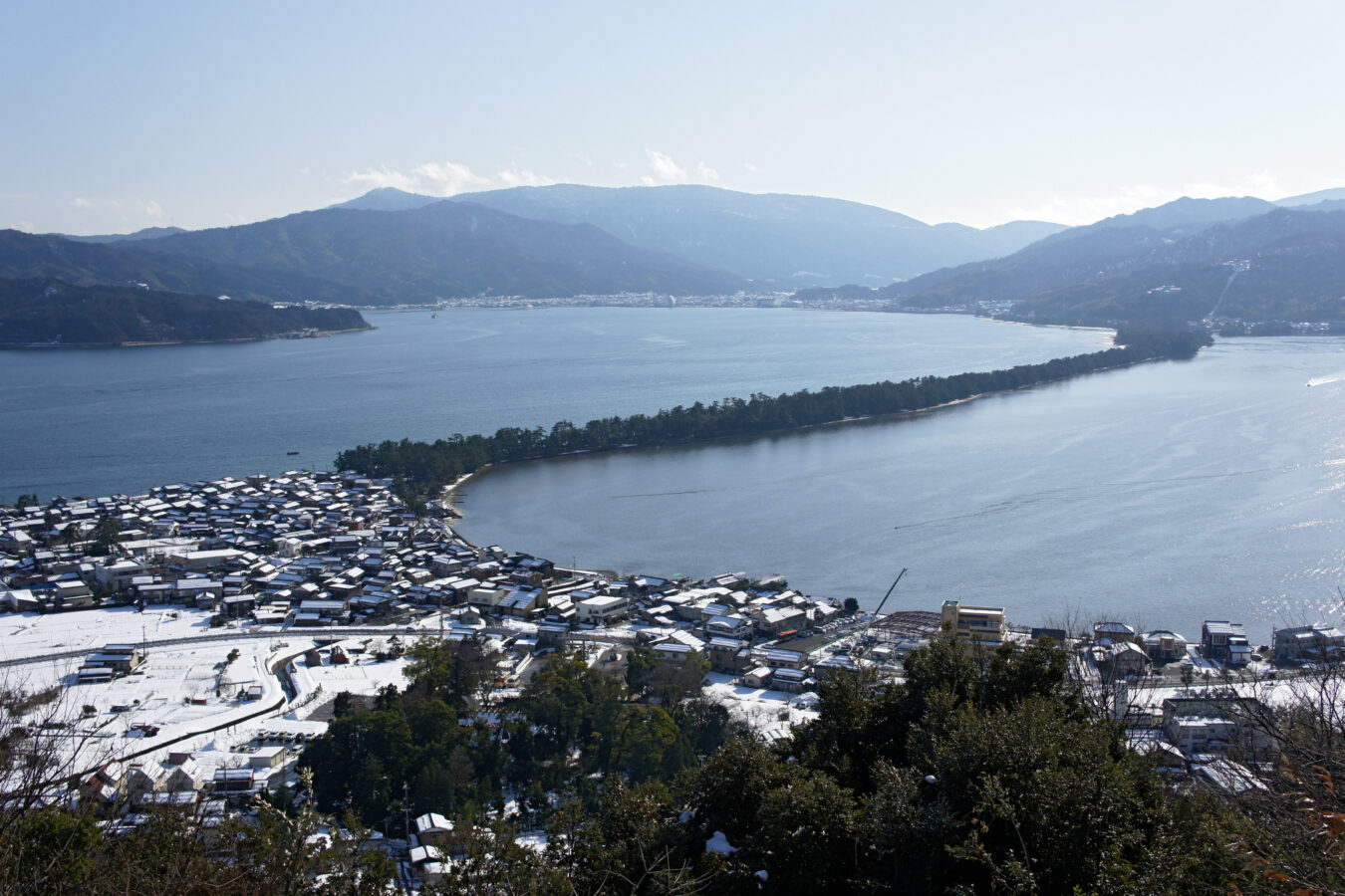
Amanohashidate is one of the Three Views of Japan: a sandbar across Miyazu Bay in northern Kyoto Prefecture. It is part of Tango-Amanohashidate-Ōeyama Quasi-National Park.
Amanohashidate Station is about 1.5 km from the point this page is mapped to, and Kono Shrine about 1.6 km. We have not checked viewpoints, so look for local information before you go.
Written by japan-spots.com (2026-09-22) from the sources credited on this page. Distances are straight lines between map positions.
Photos
Photos from Wikimedia Commons, each under its own licence — see credits
- Amanohashidate view from Kasamatsu Park01s3s4410 — 663highland · CC BY 2.5 · source · resized
- 天橋立砂浜 — Tenkyoritsu · CC BY-SA 4.0 · source · resized
- View from the observatory of Nariai-ji Temple in Miyazu, Kyoto 01 — Naokijp · CC BY-SA 4.0 · source · resized
- Swivel bridge in Amanohashidate Kyoto,JAPAN — ja:User:Si-take. · CC BY-SA 3.0 · source · resized
- View of Ama-no-Hashidate — Sesshū Tōyō · Public domain · source · resized
- Isoshimizu — ブルーノ・プラス · CC BY 4.0 · source · resized
- Amanohashidate view from Mt Moju02s3s4592 — 663highland · CC BY 2.5 · source · resized
- Amanohashidate Miyazu Bay02o4592 — 663highland · CC BY 2.5 · source · resized
- Amanohashidate Hashidate-myojin01n4200 — 663highland · CC BY 2.5 · source · resized
- AMANO-HASHIDATE (Road in sand bar) Kyoto,JAPAN — ja:User:Si-take. · CC BY-SA 3.0 · source · resized
What this place is
Amanohashidate (天橋立) is one of Japan's three scenic views. It is a sandbar located in Miyazu Bay in northern Kyoto Prefecture. It forms part of the Tango-Amanohashidate-Ōeyama Quasi-National Park.
Background text from Wikipedia (CC BY-SA 4.0)
What to expect at this type of place: Cityscape
Nearby station
Nearby station: Amanohashidate (Miyatoyo line), about 1.5 km from the spot in a straight line.
Worked out on 2026-09-14 from this place’s map position, using HeartRails Express station data and station names from Wikidata. The distance is a straight line, not a walking route, and says nothing about buses, transfers or timetables — plan the trip on Google Maps.
Traveler reviews
No reviews yet — be the first to share how it went.