Usual hours and prices, checked 2026-10-06 against the sources under “What this place is”. They can change for holidays and events — confirm before you go. Official site
Our guide
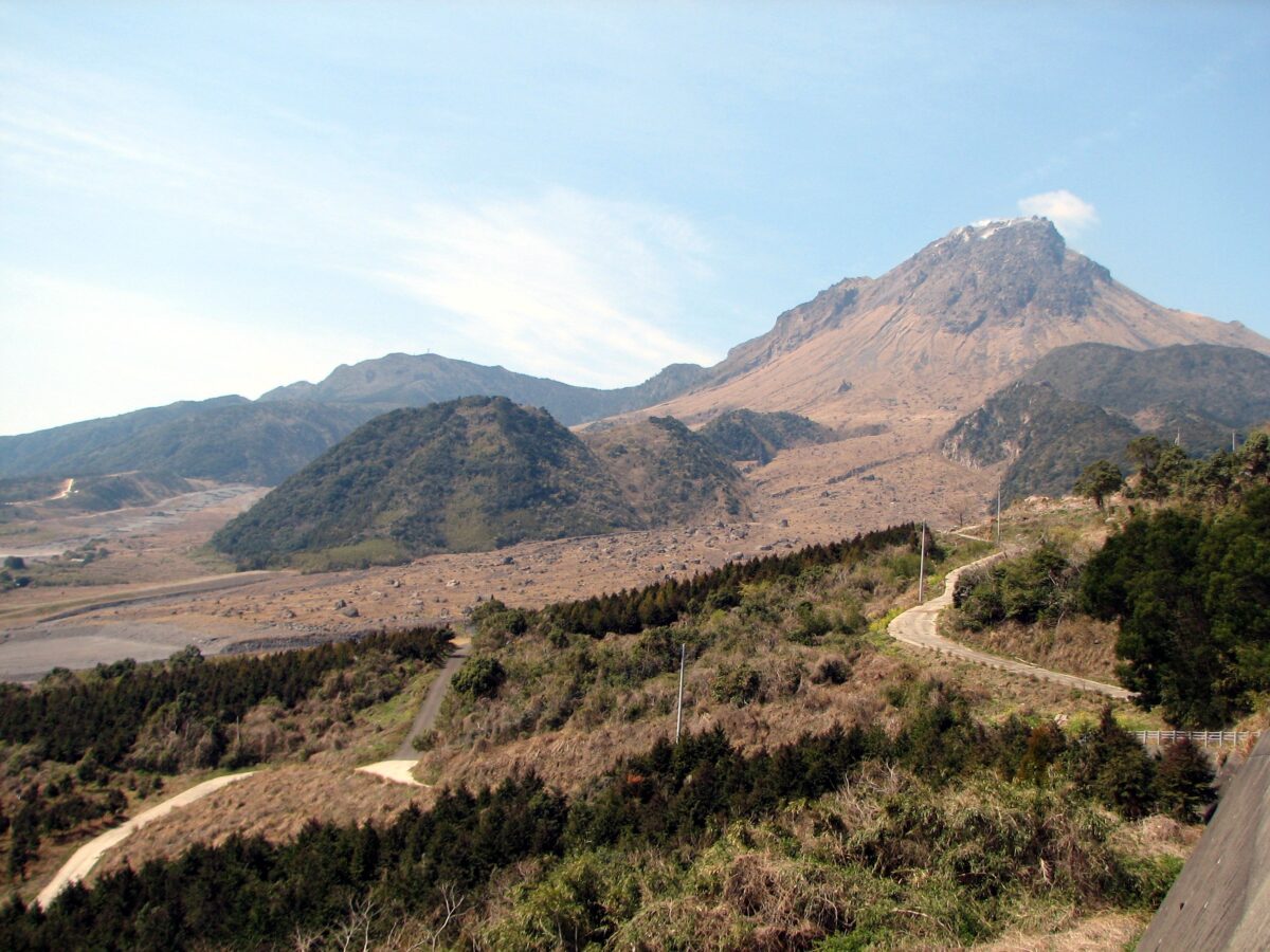
Mount Unzen, near Shimabara, Nagasaki, is an active stratovolcano made up of several overlapping cones. Its history is one of disaster: in 1792 the collapse of one of its lava domes set off a megatsunami that killed 14,524 people, Japan's worst volcanic disaster. It was last active from 1990 to 1995, and a large eruption in 1991 sent down a pyroclastic flow that killed 43 people, three volcanologists among them.
Its highest peaks are Fugen-dake, 1,359 m, and Heisei-shinzan, 1,486 m, which rose during those eruptions of the early Heisei era and is named after it.
Unzen Onsen is about 4.2 km away. As an active volcano, check current conditions and local information before you go; we have not checked trails or a public-transport route.
Written by japan-spots.com (2026-09-22) from the sources credited on this page. Distances are straight lines between map positions.
Photos
Photos from Wikimedia Commons, each under its own licence — see credits
- Fugendake 02 Pyroplastic flow area — Chris 73 (uploader on Commons) · CC BY-SA 3.0 · source · resized
- 普賢岳から見た平成新山2 — Koda6029 · CC BY-SA 4.0 · source · resized
- Kyu oonokobasyou003 — Opqr · CC BY-SA 3.0 · source · resized
- Kyu oonokobasyou001 — Opqr · CC BY-SA 3.0 · source · resized
- 140322 Unzen Ropeway Nagasaki pref Japan02s3 — 663highland · CC BY 2.5 · source · resized
- 140322 Mt Yadake Nagasaki pref Japan01s3 — 663highland · CC BY 2.5 · source · resized
- 140322 Mt Unzen Nita Pass Mt Nodake Nagasaki pref Japan01s3 — 663highland · CC BY 2.5 · source · resized
- 140322 Mt Unzen Mt Myokendake Nagasaki pref Japan01s3 — 663highland · CC BY 2.5 · source · resized
What this place is
Mount Unzen (雲仙岳, Unzen-dake) is an active stratovolcano of several overlapping small, volcanic cones, near the city of Shimabara, Nagasaki on the island of Kyushu, Japan's southernmost main island. In 1792, the collapse of one of its several lava domes triggered a megatsunami that killed 14,524 people in Japan's worst volcanic-related disaster. The volcano was most recently active from 1990 to 1995, and a large eruption in 1991 generated a pyroclastic flow that killed 43 people, including three volcanologists. Its highest peaks are Fugen-dake (普賢岳) at 1,359 metres (4,459 ft) and Heisei-shinzan (平成新山) at 1,486 metres (4,875 ft). The latter emerged during the eruptions of the early, eponymous Heisei era (1989–2019).
Visitor information checked: 2026-10-06 · Official visitor information
Background text from Wikipedia (CC BY-SA 4.0)
What to expect at this type of place: Mountain
Getting there
We do not have step-by-step transit directions for this spot yet. Open the location on Google Maps for routes from where you are staying.
Traveler reviews
No reviews yet — be the first to share how it went.