Opening hours and admission for this place have not been checked yet, so none are shown. Check the official site
Our guide
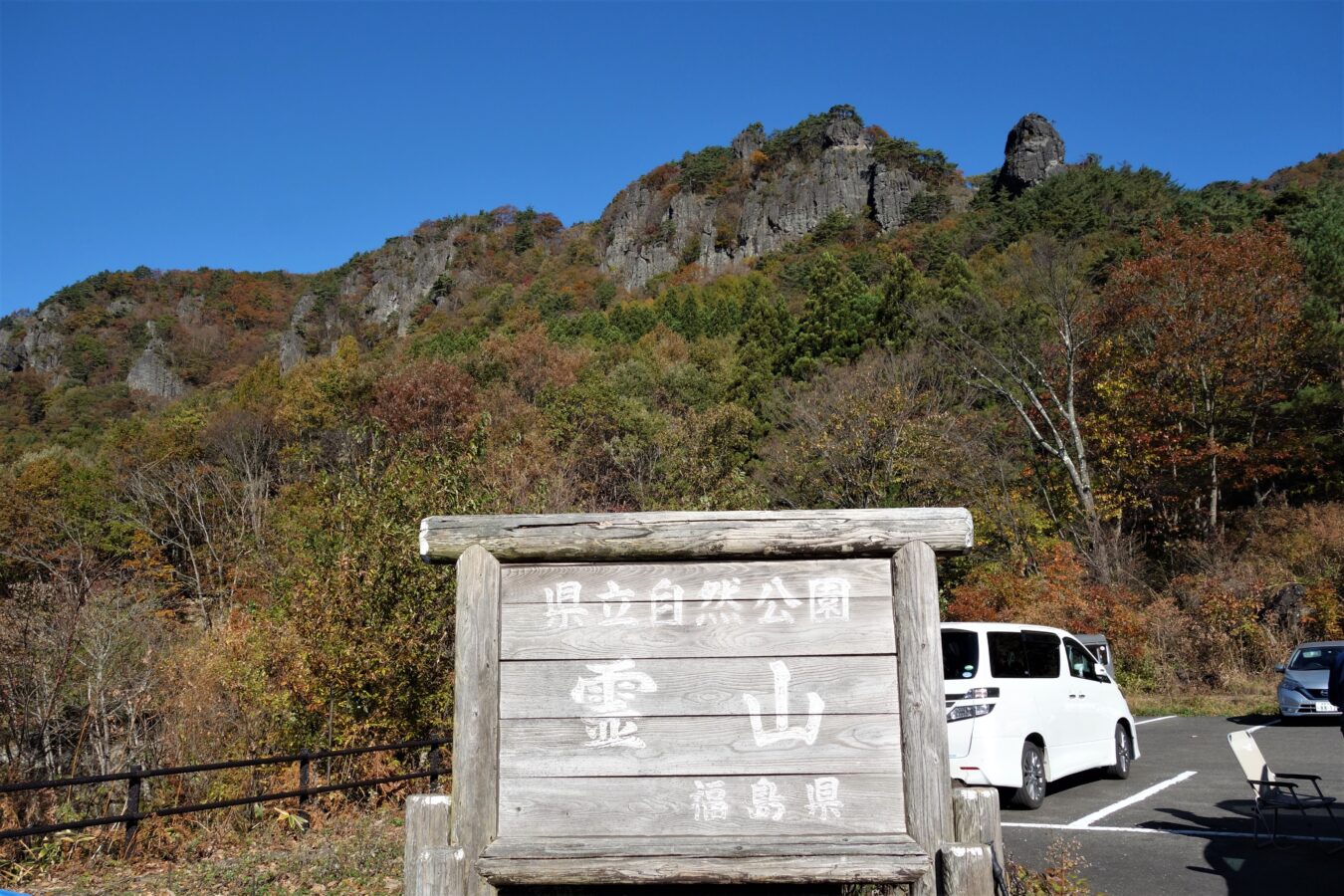
Mount Ryōzen, 825 m, stands on the border of the city of Sōma and the former town of Ryōzen, now part of Date, Fukushima. Along its hiking trail are the sites of Ryōzen Temple and Ryōzen Castle. It was chosen as one of the 100 Landscapes of Japan, is a national Place of Scenic Beauty and a National Historic Site, and is known for its autumn colours.
Ryōzen Shrine is on the mountain. We have not checked the trail or a public-transport route, so check local information and the weather before you go.
Written by japan-spots.com (2026-09-22) from the sources credited on this page. Distances are straight lines between map positions.
Photos
Photos from Wikimedia Commons, each under its own licence — see credits
- 登山口からの霊山2 — Koda6029 · CC BY-SA 4.0 · source · resized
- 霊山城跡2 — Koda6029 · CC BY-SA 4.0 · source · resized
- 護摩壇2 — Koda6029 · CC BY-SA 4.0 · source · resized
- 西物見岩から見た蔵王2 — Koda6029 · CC BY-SA 4.0 · source · resized
- 蟻の戸渡り(霊山)2 — Koda6029 · CC BY-SA 4.0 · source · resized
- 登山基地となるりょうぜん紅彩館2 — Koda6029 · CC BY-SA 4.0 · source · resized
- 望洋台からの猿跳岩2 — Koda6029 · CC BY-SA 4.0 · source · resized
- 弁天岩にて2 — Koda6029 · CC BY-SA 4.0 · source · resized
- 天狗の相撲場2 — Koda6029 · CC BY-SA 4.0 · source · resized
What this place is
Mount Ryōzen (霊山, Ryōzen) is a mountain on the border of Sōma and the former town of Ryōzen, in Date, Fukushima. It is 825 metres (2,707 ft) in height. Along the hiking trail are the sites of what were Ryōzen Temple and Ryōzen Castle. The mountain is listed as one of the 100 Landscapes of Japan in a contest sponsored by the Tokyo Nichi Nichi Shimbun and Osaka Mainichi Shimbun. It is also a national Place of Scenic Beauty as determined by the Agency for Cultural Affairs in Japan and is noted for its autumn foliage and a National Historic Site of Japan.
Background text from Wikipedia (CC BY-SA 4.0)
What to expect at this type of place: Mountain
Getting there
We do not have step-by-step transit directions for this spot yet. Open the location on Google Maps for routes from where you are staying.
Traveler reviews
No reviews yet — be the first to share how it went.