Opening hours and admission for this place have not been checked yet, so none are shown. Check the official site
Our guide
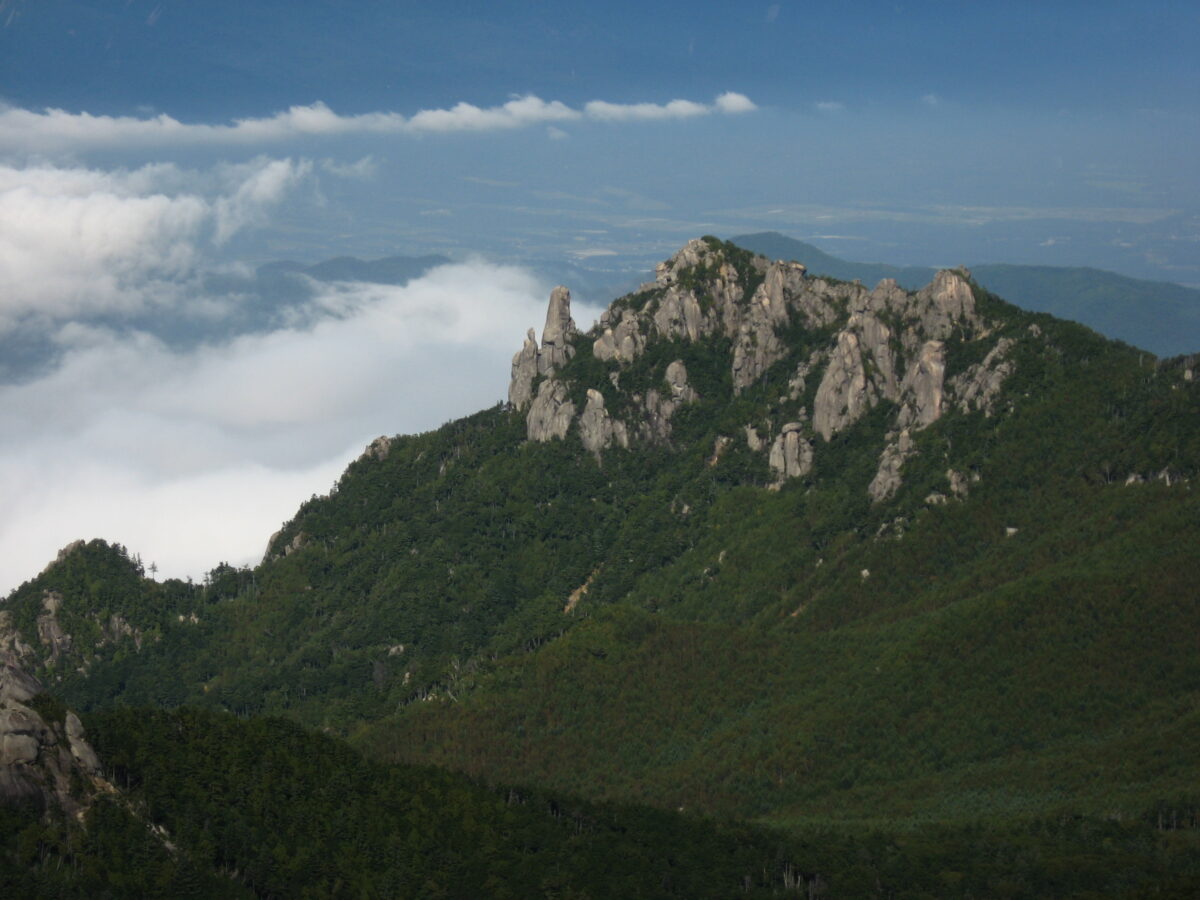
Mount Mizugaki, 2,230 m, is in the city of Hokuto, Yamanashi, within Chichibu Tama Kai National Park, and is one of the 100 Famous Japanese Mountains. Part of the Oku-Chichibu range, it stands across from Mount Kinpu. It is made mainly of granite, with a striking outline of oddly shaped and huge rocks that contrasts with the forested Chichibu mountains, and it has beautiful flowers in summer. The summit view is magnificent, and it is especially popular with hikers in the fresh-green and autumn-leaf seasons.
We have not checked routes or conditions ourselves, so check local information and the weather before you go.
Written by japan-spots.com (2026-09-22) from the sources credited on this page. Distances are straight lines between map positions.
Photos
Photos from Wikimedia Commons, each under its own licence — see credits
- Mt.Mizugaki 02 — Σ64 · CC BY-SA 3.0 · source · resized
- 桃太郎岩 — Koda6029 · CC BY-SA 4.0 · source · resized
- Mt.Mizugaki and Mt.Yatsugatake 01 — Σ64 · CC BY 3.0 · source · resized
- Mt.Mizugaki Oyasuri-iwa 02 — Σ64 · CC BY-SA 3.0 · source · resized
- Mount Mizugaki (28083906050) — Takuya ASADA · CC BY 2.0 · source · resized
- Mount Mizugaki — RESPITE · CC0 · source · resized
- Mt.Mizugaki 05 — Σ64 · CC BY-SA 3.0 · source · resized
- Mount Mizugaki and Yatsugatake from Dainichi-iwa — Alpsdake · CC BY-SA 3.0 · source · resized
- Mount Mizugaki from Dainichi-iwa — Alpsdake · CC BY-SA 3.0 · source · resized
- 瑞牆山と黒森温泉 - panoramio — mapplefan8 · CC BY-SA 3.0 · source · resized
What this place is
Mount Mizugaki (瑞牆山 Mizugaki-san) is a mountain located in Hokuto-city, in the Yamanashi Prefecture, within Chichibu Tama Kai National Park. It is one of the 100 Famous Japanese Mountains. It is part of the Okuchichibu Mountains. It has an altitude of 2230m. The mountain is located just across from Mount Kinpu. The mountain is composed mainly of granite, and has beautiful flowers in summer. Mount Mizugaki has a unique shape consisting of a number of granite rocks, strangely shaped rocks and huge rocks that is opposite to Chichibu mountains covered with rich woods. The view from the peak is magnificent and hiking routes are in good condition. Many hikers walk here especially in the seasons of fresh green and autumn leaves.
Background text from Wikipedia (CC BY-SA 4.0)
What to expect at this type of place: Mountain
Getting there
We do not have step-by-step transit directions for this spot yet. Open the location on Google Maps for routes from where you are staying.
Traveler reviews
No reviews yet — be the first to share how it went.