Opening hours and admission for this place have not been checked yet, so none are shown. Check the official site
Our guide
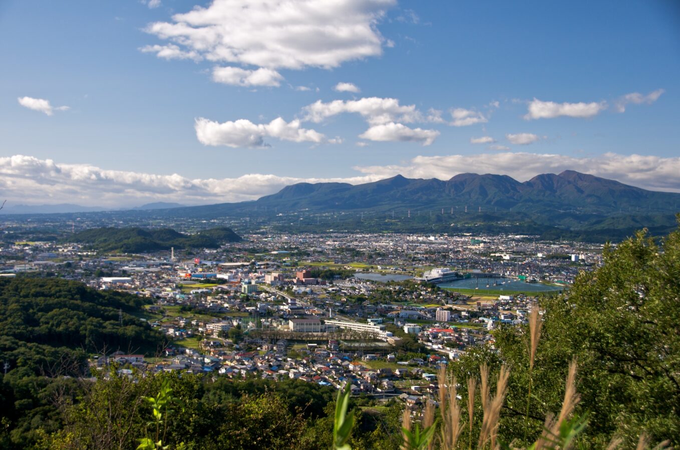
Mount Akagi is a broad, low stratovolcano, mostly of andesite, rising above the northern end of the Kantō Plain in Gunma. At its top is an oval caldera about 3 km by 4 km, with later lava domes in a line from north-west to south-east, and Lake Ono at the caldera's north-east end. An older volcano here partly collapsed, leaving a debris-avalanche deposit on the south flank; a second grew during the Pleistocene amid a series of large Plinian eruptions, and the central cone began to form after the last of them, about 31,000 years ago.
We have not checked roads, trails or a public-transport route, so check local information and the weather before you go.
Written by japan-spots.com (2026-09-22) from the sources credited on this page. Distances are straight lines between map positions.
Photos
Photos from Wikimedia Commons, each under its own licence — see credits
- MountAkagi — Javbw · CC BY-SA 3.0 · source · resized
- Maebashi20080227 — Javbw · CC BY 3.0 · source · resized
- Kurobiyama-ookami (Mt. Akagi) — Saigen Jiro · CC0 · source · resized
- Kakumanbuchi — uraomote_yamaneko · CC BY-SA 3.0 · source · resized
- Akagiyama ono — Uraomote yamaneko · CC BY-SA 3.0 · source · resized
- Akagiyama07 — Mass Ave 975 · CC BY-SA 3.0 · source · resized
- Akagiyama06 — Mass Ave 975 · CC BY-SA 3.0 · source · resized
What this place is
Mount Akagi (赤城山, Akagi-yama; Red Castle) is a stratovolcano in Gunma Prefecture, Japan. The broad, low dominantly andesitic stratovolcano rises above the northern end of the Kanto Plain. It contains an elliptical, 3 km × 4 km (1.9 mi × 2.5 mi) summit caldera with post-caldera lava domes arranged along a NW–SE line. Lake Ono is located at the NE end of the caldera. An older stratovolcano was partially destroyed by edifice collapse, producing a debris-avalanche deposit along the south flank.A series of large plinian eruptions accompanied growth of a second stratovolcano during the Pleistocene. Construction of the central cone in the late-Pleistocene summit caldera began following the last of the plinian eruptions about 31,000 years ago.
Background text from Wikipedia (CC BY-SA 4.0)
What to expect at this type of place: Mountain
Getting there
We do not have step-by-step transit directions for this spot yet. Open the location on Google Maps for routes from where you are staying.
Traveler reviews
No reviews yet — be the first to share how it went.