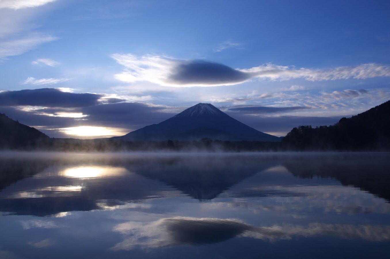
Opening hours and admission for this place have not been checked yet, so none are shown. Check the official site
Our guide
Lake Shōji, in the town of Fujikawaguchiko, is the smallest of the Fuji Five Lakes by surface area and the third deepest, at up to 15.2 m. Its surface lies at 900 m, the same as Lake Sai and Lake Motosu, which shows that the three were once a single lake, divided by a huge lava flow from Mount Fuji in the eruption of 864–868. The remains of that flow now lie under the forest of Aokigahara, and there is evidence that the three lakes are still linked underground. The lake is within Fuji-Hakone-Izu National Park.
Aokigahara is about 2.5 km away and Lake Motosu about 3.6 km. We have not checked a public-transport route.
Written by japan-spots.com (2026-09-22) from the sources credited on this page. Distances are straight lines between map positions.
Photos
Photos from Wikimedia Commons, each under its own licence — see credits
- Mt.Fuji and Lake Shojiko — hogeasdf · CC BY 2.0 · source · resized
- Mount Fuji from Lake Shōji — Alpsdake · CC BY-SA 4.0 · source · resized
- Lake Shōji from Panoramadai — Alpsdake · CC BY-SA 4.0 · source · resized
- Lake Shoji from panoramadai — Alpsdake · CC BY-SA 3.0 · source · resized
- Autumn leaves at Lake Shoji — Mikkabie · CC BY-SA 4.0 · source · resized
- Mount Sanpobun from Lake Shoji — Alpsdake · CC BY-SA 4.0 · source · resized
What this place is
Lake Shōji (精進湖, Shōji-ko) is one of the Fuji Five Lakes and located in the town of Fujikawaguchiko in southern Yamanashi Prefecture near Mount Fuji, Japan. Lake Shōji is the smallest of the Fuji Five Lakes in terms of surface area, and third deepest, with a maximum water depth of 15.2 metres (50 ft). Its surface elevation of 900 metres (3,000 ft) is the same as that of Lake Motosu and Lake Sai, confirming that these three lakes were originally a single lake, which was divided into three by an enormous lava flow from Mount Fuji during an eruption from 864-868 AD.The remnants of the lava flow are now under the Aokigahara Jukai Forest, and there is evidence to indicate that these three lakes remain connected by underground waterways. The lake is within the borders of the Fuji-Hakone-Izu National Park.
Background text from Wikipedia (CC BY-SA 4.0)
What to expect at this type of place: Lakes & falls
Getting there
We do not have step-by-step transit directions for this spot yet. Open the location on Google Maps for routes from where you are staying.
Traveler reviews
No reviews yet — be the first to share how it went.