Usual hours and prices, checked 2026-10-06 against the sources under “What this place is”. They can change for holidays and events — confirm before you go. Official site
Our guide
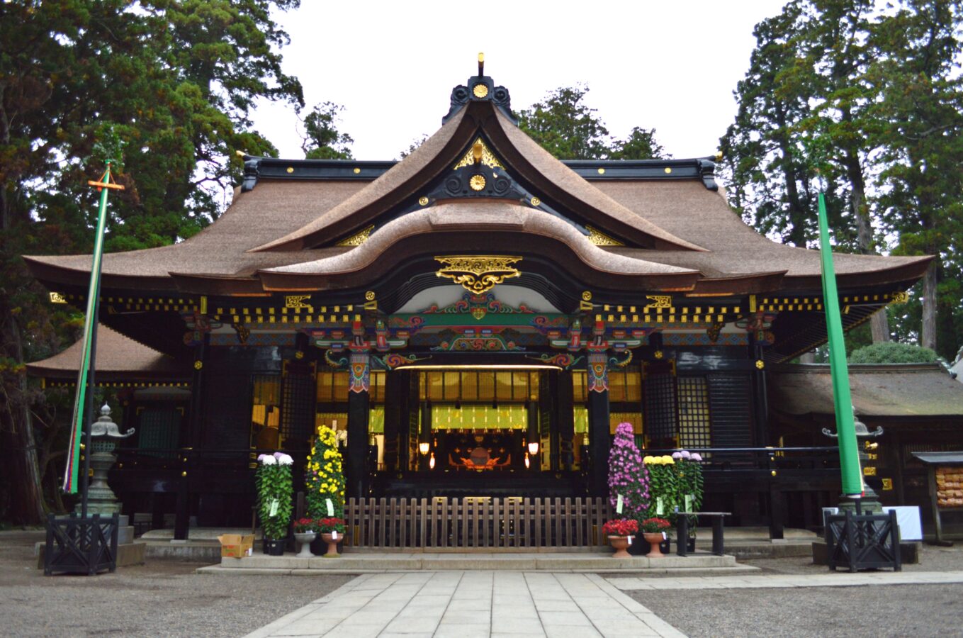
Katori Jingū, in the city of Katori, Chiba, is the ichinomiya of the former Shimōsa Province and the head shrine of about 400 Katori shrines across Japan, most of them in the Kantō region. Its main festival is held every year on 14 April, and a three-day Grand Festival is held once every 12 years.
Sawara Historic Town is about 2.7 km away in a straight line, and Katori Station on the Kashima Line about 1.4 km.
Written by japan-spots.com (2026-09-22) from the sources credited on this page. Distances are straight lines between map positions.
Photos
Photos from Wikimedia Commons, each under its own licence — see credits
- Katori-jingu haiden shomen — Saigen Jiro · CC0 · source · resized
- Katori-jingu honden — Saigen Jiro · CC0 · source · resized
- Katori-jingu haiden — Saigen Jiro · CC0 · source · resized
- Kashimashingu-sha (Katori-jingu)-2 — Saigen Jiro · CC0 · source · resized
- Kaname-ishi-stone,katori-jingu,katori-city.japan — katorisi · CC BY 2.5 · source · resized
- Joyatou (Tsunomiya, Katori) — Saigen Jiro · CC0 · source · resized
- Jinko Festival,Tsunomiya,Katori Jingu Shrine,Katori-city,Japan — Katorisi · CC BY-SA 3.0 · source · resized
What this place is
The Katori Shrine (香取神宮, Katori Jingū) is a Shintō shrine in the city of Katori in Chiba Prefecture, Japan. It is the ichinomiya of former Shimōsa Province, and is the head shrine of the approximately 400 Katori shrines around the country (located primarily in the Kantō region). The main festival of the shrine is held annually on April 14, with a three-day Grand Festival held every 12 years.
Visitor information checked: 2026-10-06 · Official visitor information
Background text from Wikipedia (CC BY-SA 4.0)
What to expect at this type of place: Shrine
Nearby station
Nearby station: Katori (Kashima Line), about 1.4 km from the spot in a straight line.
Worked out on 2026-09-14 from this place’s map position, using HeartRails Express station data and station names from Wikidata. The distance is a straight line, not a walking route, and says nothing about buses, transfers or timetables — plan the trip on Google Maps.
Traveler reviews
No reviews yet — be the first to share how it went.