Opening hours and admission for this place have not been checked yet, so none are shown. Check the official site
Our guide
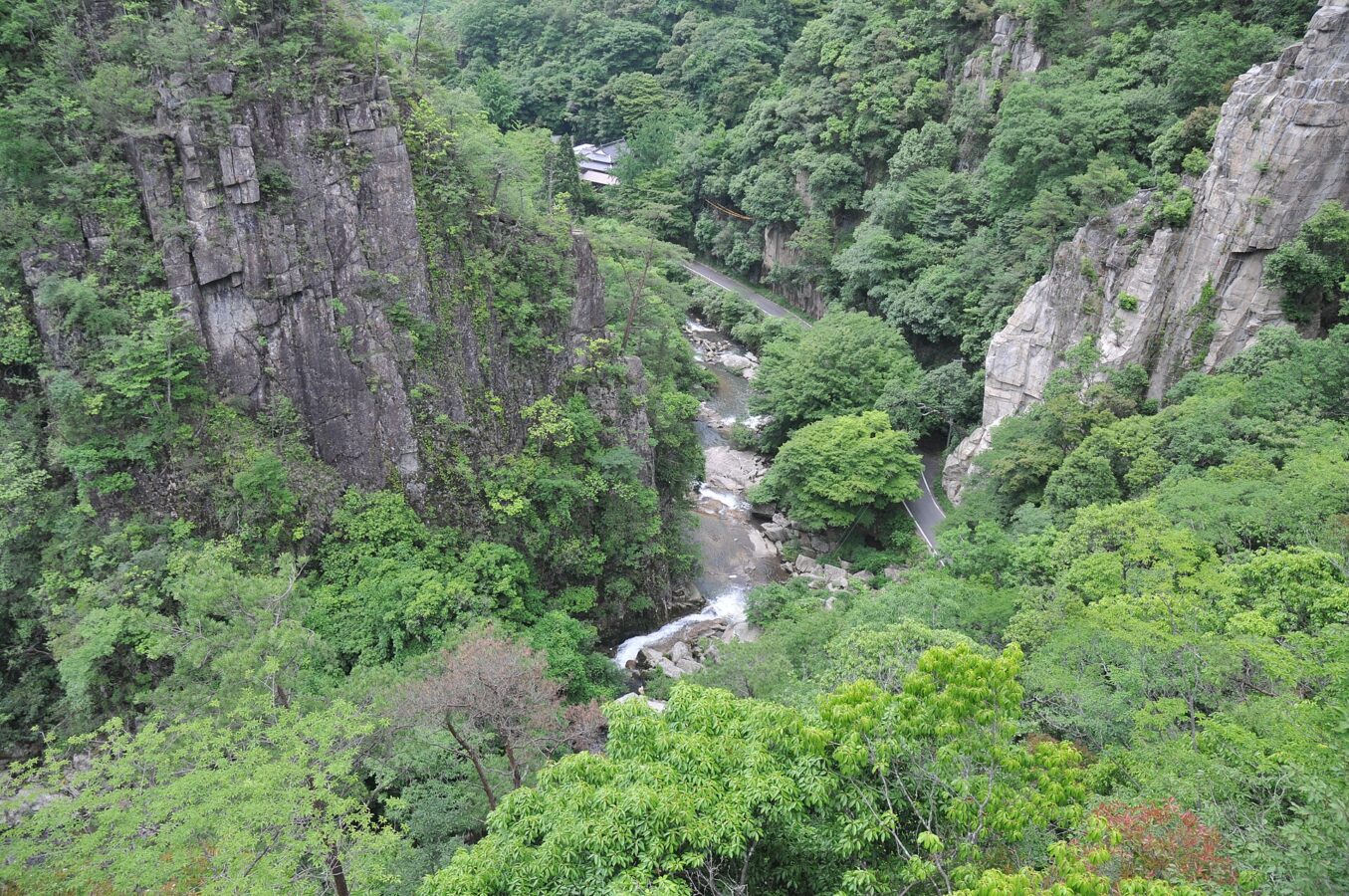
Gōkei is a river valley formed by the Makidani River, a tributary of the Takahashi, running from the far north of the city of Sōja into Kibichūō (formerly Kayō), Okayama. It is only about 600 m long, but full of strange granite rocks shaped by wind and rain, and it was listed as a national Place of Scenic Beauty in 1923. Known features include the 330 m Ganpō rock peak, Tenchūzan, Kengamine and Mount Unate.
Our source says the gorge is reached by Okayama Prefectural Route 57, the Sōja–Kayō road; we have not checked public transport.
Written by japan-spots.com (2026-09-22) from the sources credited on this page. Distances are straight lines between map positions.
Photos
Photos from Wikimedia Commons, each under its own licence — see credits
- Gokei 04 — Reggaeman · CC BY-SA 3.0 · source · resized
- Goukei 19 — Reggaeman · CC BY-SA 3.0 · source · resized
- Goukei 18 — Reggaeman · CC BY-SA 3.0 · source · resized
- Goukei 12 — Reggaeman · CC BY-SA 3.0 · source · resized
- Goukei 07 — Reggaeman · CC BY-SA 3.0 · source · resized
- Gokei 02 — Reggaeman · CC BY-SA 3.0 · source · resized
- Goukei 11 — Reggaeman · CC BY-SA 3.0 · source · resized
- Gokei 03 — Reggaeman · CC BY-SA 3.0 · source · resized
- Gokei 01 — Reggaeman · CC BY-SA 3.0 · source · resized
What this place is
The Gōkei area (豪渓, Gōkei) is a river valley formed by the Makidani River (a tributary of the Takahashi River) which stretched from the extreme northern part of Sōja to Kibichūō (formerly Kayō) in Okayama Prefecture, Japan. The area is only about 600m long, but the area is filled with strange granite rock formations resulting from wind and rain erosion. The area has become a local attraction for those wanting to view the scenic beauty and the strange formations, leading to its listing in 1923 as a national scenic spot in Japan. Some well known spots of interest within the Gōkei area include the 330m high Ganpō (岩峰), Tenchūzan (天柱山), as well as Kengamine (剣峰) and Unate Mountain (雲梯山, Unatesan). The area is accessible via Okayama Prefectural Route 57 (also known as the Sōja-Kayō Route).
Background text from Wikipedia (CC BY-SA 4.0)
What to expect at this type of place: Lakes & falls
Getting there
We do not have step-by-step transit directions for this spot yet. Open the location on Google Maps for routes from where you are staying.
Traveler reviews
No reviews yet — be the first to share how it went.