Opening hours and admission for this place have not been checked yet, so none are shown. Check the official site
Our guide
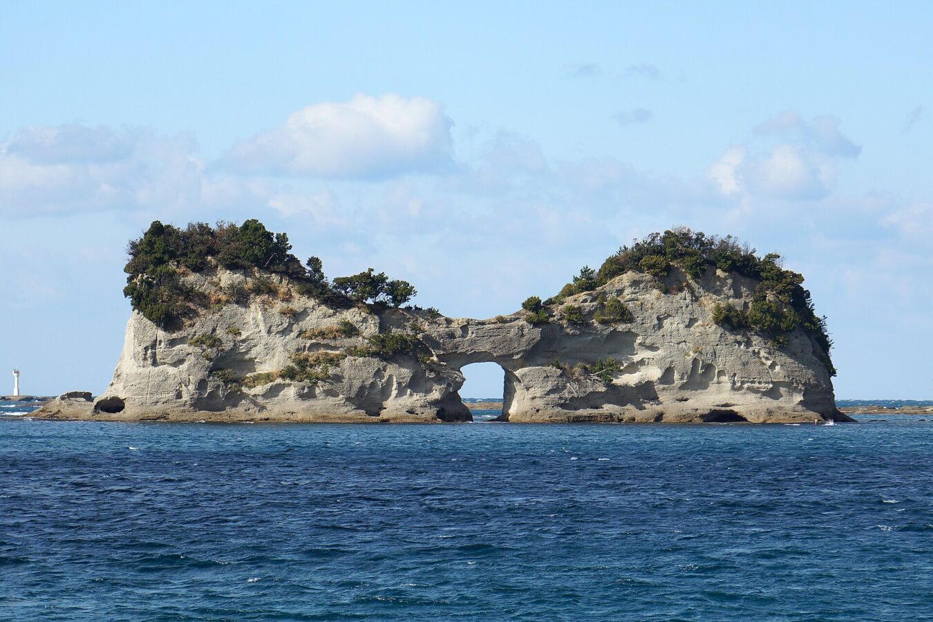
Engetsu Island is the common name of Takashima, a small uninhabited islet off Shirahama, Wakayama, and one of the symbols of the area. Wind and waves have worn a natural arch through it: the round hole, about 9 m across, gives it the name Engetsu, “full moon”. The islet is about 130 m long north to south, 35 m wide and up to 25 m high, and it is a Place of Scenic Beauty.
Around the spring and autumn equinoxes the sun can be seen setting through the hole. The water around the islet is much clearer than at nearby Shirahama Beach, about 1 km away, and many kinds of fish can be seen.
We have not checked a public-transport route, so plan the journey on the map.
Written by japan-spots.com (2026-09-22) from the sources credited on this page. Distances are straight lines between map positions.
Photos
Photos from Wikimedia Commons, each under its own licence — see credits
- 131222 Engetsu Island Shirahama Wakayama pref Japan01bs — 663highland · CC BY 2.5 · source · resized
- Sunset at Engetsu Islet — Guldeen · CC BY-SA 3.0 · source · resized
- Engetsu Island Feb2010 — 玄史生 · CC BY-SA 3.0 · source · resized
- Engetsu Island060505 — PAMU · CC BY-SA 3.0 · source · resized
- Engetsu Island Nearview — 玄史生 · Public domain · source · resized
- 131221 Engetsu Island Shirahama Wakayama pref Japan01s3 — 663highland · CC BY 2.5 · source · resized
- 131221 Engetsu Island Shirahama Wakayama pref Japan02s3 — 663highland · CC BY 2.5 · source · resized
- 131222 Engetsu Island Shirahama Wakayama pref Japan02bs3 — 663highland · CC BY 2.5 · source · resized
- 黄昏の円月島 (Engetsu Island with twilight) 19 Aug, 2013 - panoramio — Hiroaki Kaneko · CC BY-SA 3.0 · source · resized
- 円月島 Engetsu Islet - panoramio — iloverjoa · CC BY 3.0 · source · resized
What this place is
Engetsu Island (円月島, Engetsu-tō) is the common name for Takashima (高嶋), a small uninhabited islet off the coast of Shirahama, Wakayama Prefecture, Japan. It is noted for having a natural arch created through the effects of erosion by wind and waves, and has been designated a National Place of Scenic Beauty. One of the symbols of the Shirahama area, the islet measures approximately 130 metres (430 ft) north-to-south and 35 metres (115 ft) east-to-west, and has a maximum elevation of 25 metres (82 ft). The circular moon-shaped hole (sea cave) in the center of the island has a diameter of nine meters and is the origin of the popular name "Engetsu" (full moon). During the spring and autumn equinoxes, the sunset can be seen through the hole in the center. Compared to the nearby Shirarahama Beach, water transparency is much higher near the islet, and many fish species can be seen.
Background text from Wikipedia (CC BY-SA 4.0)
What to expect at this type of place: Island
Getting there
We do not have step-by-step transit directions for this spot yet. Open the location on Google Maps for routes from where you are staying.
Traveler reviews
No reviews yet — be the first to share how it went.