Opening hours and admission for this place have not been checked yet, so none are shown. Check the official site
Our guide
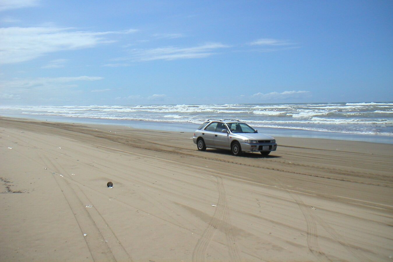
The Chirihama Nagisa Driveway is a sightseeing road about 8 km long that runs along the beach itself, from Imahama in Hōdatsushimizu to Chirihama in Hakui, Ishikawa. It is the only road in Japan where ordinary cars and buses can drive along the water's edge on the sand, and the same stretch also serves as a bathing beach.
Hakui Station on the Nanao Line is about 1.9 km from the point this page is mapped to, in a straight line. Keta Taisha is about 4.1 km away. We have not checked whether the road is open on a given day, so look for local information before you drive.
Written by japan-spots.com (2026-09-22) from the sources credited on this page. Distances are straight lines between map positions.
Photos
Photos from Wikimedia Commons, each under its own licence — see credits
- Chirihama nagisa driveway — Kwekwe · CC BY-SA 3.0 · source · resized
- Speed Limit Sign in Nagisa Driveway — SONIC BLOOMING · CC BY-SA 4.0 · source · resized
- Hokutetsu 18-108 in Chirihama Nagisa Driveway — SONIC BLOOMING · CC BY-SA 4.0 · source · resized
- Chirihama Nagisa Driveway 2020 — SONIC BLOOMING · CC BY-SA 4.0 · source · resized
- (石川県) 千里浜なぎさドライブウェイ。日本で唯一自動車等で砂浜の波打ち際を走ることができる道路。ちょうど日の出 - panoramio — Shift · CC BY-SA 3.0 · source · resized
- Chirihama Driveway 200906 — Totti · CC BY-SA 4.0 · source · resized
- SSTR2021 20211009 174217 — み · CC BY-SA 4.0 · source · resized
What this place is
The Chirihama Nagisa Driveway (千里浜なぎさドライブウェイ) is a sightseeing road about 8 km long along the beach from Imahama in Hōdatsushimizu to Chirihama in Hakui, Ishikawa Prefecture, which also serves as a bathing beach. It is the only road in Japan where ordinary cars and buses can drive along the water's edge on the sand.
Background text translated from Japanese Wikipedia (CC BY-SA 4.0)
What to expect at this type of place: Coast
Nearby station
Nearby station: Hakui (Nanao Line), about 1.9 km from the spot in a straight line.
Worked out on 2026-09-14 from this place’s map position, using HeartRails Express station data and station names from Wikidata. The distance is a straight line, not a walking route, and says nothing about buses, transfers or timetables — plan the trip on Google Maps.
Traveler reviews
No reviews yet — be the first to share how it went.