Opening hours and admission for this place have not been checked yet, so none are shown. Check the official site
Our guide
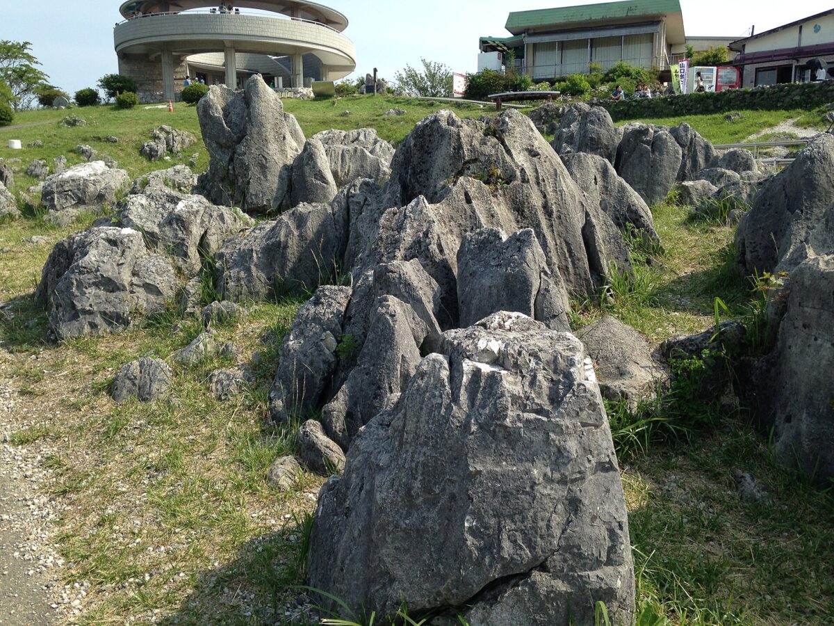
Akiyoshidai is a karst plateau in Yamaguchi, covering some 130 km², with more than 400 limestone caves. Part of it forms Akiyoshidai Quasi-National Park, founded on 1 November 1955 with an area of 45.02 km² and managed by the prefecture. The underground water system of Akiyoshidai is a Ramsar-listed wetland of international importance.
One of the caves, Akiyoshido Cave, is about 1.7 km away. We have not checked a public-transport route, so plan the journey on the map and look for local information before you go.
Written by japan-spots.com (2026-09-22) from the sources credited on this page. Distances are straight lines between map positions.
Photos
Photos from Wikimedia Commons, each under its own licence — see credits
- Limestones on Akiyoshi Plateau 2 — そらみみ (Soramimi) · CC BY-SA 4.0 · source · resized
- Akiyoshidai open burning — Tu-ka-pon · CC BY-SA 3.0 · source · resized
- Akiyoshi Plateau from Akiyoshidai Karst Observation Deck (north) — そらみみ (Soramimi) · CC BY-SA 4.0 · source · resized
- Akiyoshidai 004 — monkist (Szabolcs Arany) · CC BY 2.0 · source · resized
- Akiyoshidai Yamaguchi Japan — Flickr user: uesakakohei https://www.flickr.com/people/uesakakohei/ · CC BY 2.0 · source · resized
- Akiyoshi Plateau 20160522 — そらみみ (Soramimi) · CC BY-SA 4.0 · source · resized
- Akiyoshi Plateau 20160522-2 — そらみみ (Soramimi) · CC BY-SA 4.0 · source · resized
- Akiyoshi Plateau 20160522-8 — そらみみ (Soramimi) · CC BY-SA 4.0 · source · resized
- Akiyoshi Plateau 20160522-11 — そらみみ (Soramimi) · CC BY-SA 4.0 · source · resized
What this place is
Akiyoshidai Kokutei Kōen (秋吉台国定公園) is a Quasi-National Park in Yamaguchi Prefecture, Japan. It was founded on 1 November 1955 and has an area of 45.02 km². It includes part of the Akiyoshi plateau (秋吉台, Akiyoshidai), a 130 square kilometre area of karst topography, as well as over 400 limestone caves. The area is rated a protected landscape (category V) according to the IUCN. Like all Quasi-National Parks in Japan, the park is managed by the local prefectural government. The Akiyoshidai Groundwater System is a Ramsar Site and wetland of international importance.
Background text from Wikipedia (CC BY-SA 4.0)
What to expect at this type of place: Mountain
Getting there
We do not have step-by-step transit directions for this spot yet. Open the location on Google Maps for routes from where you are staying.
Traveler reviews
No reviews yet — be the first to share how it went.