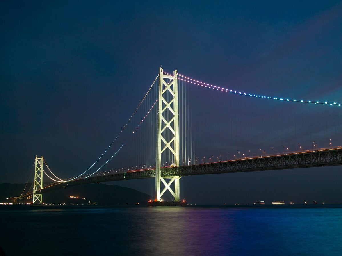
Akashi Kaikyo Bridge viewpoint
明石海峡大橋
No opening hours or admission are shown: the sources we checked on 2026-09-15 were used for the route only. Check the official site
AD 🛏️ Hotels nearby on Agoda ↗ About this link
Our guide
The Akashi Kaikyo Bridge carries the expressway from Kobe, on Honshu, across the busy and turbulent Akashi Strait to Iwaya on Awaji Island. When it was finished in 1998 its central span, 1,991 m, was the longest of any suspension bridge in the world; since the Çanakkale Bridge in Turkey opened in 2022 it is the second-longest. It is one of the key links in the three routes built across the Seto Inland Sea between Honshu and Shikoku.
The route we have checked is to the Kobe end, where the Bridge Exhibition Center is about 5 minutes on foot from JR Maiko Station. One trap to avoid: the Kōsoku Maiko highway bus stop is close by, but buses heading toward Awaji do not let passengers off there.
The bridge leads on to Awaji Island; on the Kobe side, Akashi Castle is about 4.8 km away in a straight line.
Written by japan-spots.com (2026-09-22) from the sources credited on this page. Distances are straight lines between map positions.
Photos
Photos from Wikimedia Commons, each under its own licence — see credits
- 明石海峡大橋 - panoramio (1) (cropped) — clear_and_sunny · CC BY 3.0 · source · resized
- TopOfPearlBridge02 — PlusMinus · CC BY-SA 3.0 · source · resized
- MaikoMarinPromenadeFloor — +- at Japanese Wikipedia · CC BY-SA 3.0 · source · resized
- Asagiri-akashiohashi — Tomomarusan · CC BY-SA 3.0 · source · resized
- Akasikaikyouoohasi01 — Dokudami · CC BY-SA 4.0 · source · resized
- Akashi Bridge — Tysto · Public domain · source · resized
- AkashiOhashiCableCutModel — +- (uploader on Commons) · CC BY-SA 3.0 · source · resized
- AkashiAnchorage — +- · CC BY-SA 3.0 · source · resized
- Akashi-Kaikyo Bridge h008 — 神戸市 · CC BY 2.1 jp · source · resized
- Akashi-Kaikyo Bridge — Tomomarusan · CC BY 2.5 · source · resized
What this place is
The Akashi Kaikyo Bridge (明石海峡大橋) is a suspension bridge that links the city of Kobe on the Japanese island of Honshu and Iwaya, Awaji on Awaji Island. It is part of the Kobe-Awaji-Naruto Expressway, and crosses the busy and turbulent Akashi Strait (Akashi Kaikyō in Japanese). It was completed in 1998, and at the time, was the longest central span of any suspension bridge in the world, at 1,991 metres (6,532 ft). Currently, it is the second-longest, behind the 1915 Çanakkale Bridge in Turkey that was opened in March 2022. The Akashi Kaikyo Bridge is one of the key links of the Honshū–Shikoku Bridge Project, which created three routes across the Seto Inland Sea.
Visitor information checked: 2026-09-15 · Honshu-Shikoku Bridge Expressway: Bridge Exhibition Center access
Background text adapted from Wikipedia (CC BY-SA 4.0)
What to expect at this type of place: Cityscape
Getting there by public transport
- The Bridge Exhibition Center at the Kobe end of the bridge is about 5 minutes on foot from JR Maiko Station (Kobe Line) and about 7 minutes from Sanyō Maiko-kōen Station.
- The Kōsoku Maiko highway bus stop is about 7 minutes away, but buses heading toward Awaji do not let passengers off there.
Route checked: 2026-09-15 · Honshu-Shikoku Bridge Expressway: Bridge Exhibition Center access · Timetables change — check the operator before you travel.
Where to stay nearby
Hotels near Akashi Kaikyo Bridge viewpoint on Agoda
AD Affiliate link: if you book through it, we may earn a commission from Agoda, at no extra cost to you. Hotels, prices and availability are Agoda’s, for the whole town around this spot.
Traveler reviews
No reviews yet — be the first to share how it went.