Usual hours and prices, checked 2026-10-07 against the sources under “What this place is”. They can change for holidays and events — confirm before you go. Official site
Our guide
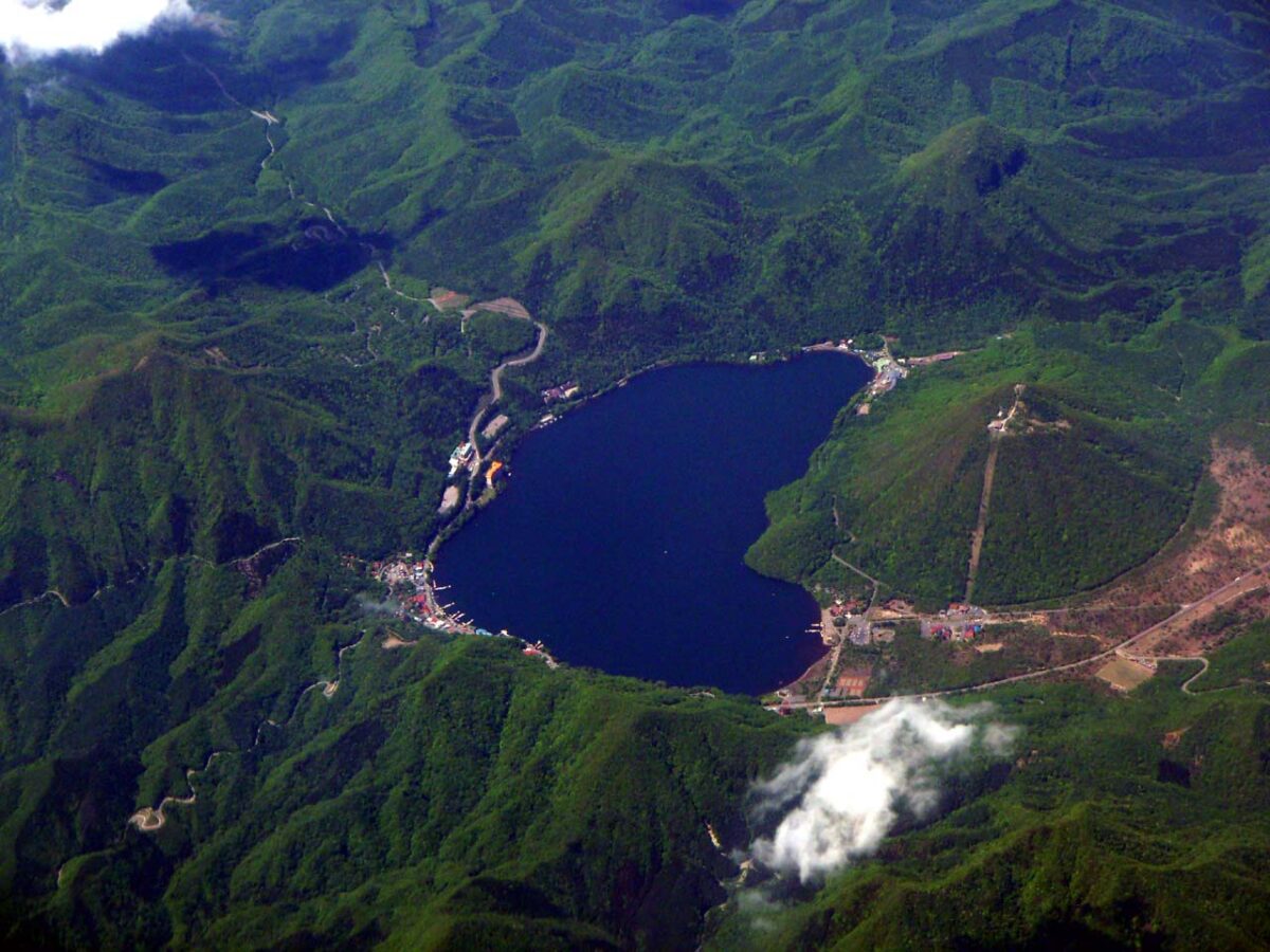
Lake Haruna is a caldera lake near the summit of Mount Haruna, within the city of Takasaki; it was once called Ikaho-numa. It is popular with campers in summer, and in winter the surface freezes for skating and ice fishing for wakasagi (smelt). The road up is one of Gunma's musical roads, playing a tune known in Japan as “At a Quiet Lakeside”, and the lake gives its name to the kayōkyoku song “Haruna-ko no shōjo”, recorded by Akira Fuse.
Haruna Shrine is about 2.2 km away. Our source mentions a bus from Takasaki Station, but we have not checked it, so look for local information before you go.
Written by japan-spots.com (2026-09-22) from the sources credited on this page. Distances are straight lines between map positions.
Photos
Photos from Wikimedia Commons, each under its own licence — see credits
- HarunaKo — BehBeh · CC BY-SA 3.0 · source · resized
- Haruna02 — Mass Ave 975 · CC BY-SA 3.0 · source · resized
- Haruna00 — Mass Ave 975 · CC BY-SA 3.0 · source · resized
- Farsari, Adolfo (1841-1898) - B11 - The Fuji of Haruna — Adolfo Farsari · Public domain · source · resized
- Akiko Yosano in western clothe — Unknown author · Public domain · source · resized
What this place is
Lake Haruna (榛名湖, Haruna-ko) is a caldera lake. It lies near the summit of Mount Haruna, within the city limits of Takasaki, Gunma Prefecture, Japan.A former name for the lake is Lake Ikaho (伊香保沼, Ikaho-numa). In the summer, the lake is a popular destination for campers. The surface freezes in the winter, and it affords skating and ice fishing for wakasagi. The lake lies a 90-minute bus ride from Takasaki Station. It can be reached in 40 minutes by car from Shibukawa-Ikaho Interchange, #12 on the Kan-Etsu Expressway. The road to the lake is one of 10 musical roads located in Gunma prefecture alone; the song played is "Sweetly Sings the Donkey," chosen because the melody is known as "At a Quiet Lakeside" in Japan.A kayōkyoku refers to the lake in its title. Akira Fuse recorded the tune, named Haruna-ko no shōjo. The music is by Rei Nakanishi and the lyrics by Ken'ichirō Morioka.
Visitor information checked: 2026-10-07 · Official visitor information
Background text from Wikipedia (CC BY-SA 4.0)
What to expect at this type of place: Lakes & falls
Getting there
We do not have step-by-step transit directions for this spot yet. Open the location on Google Maps for routes from where you are staying.
Traveler reviews
No reviews yet — be the first to share how it went.