Opening hours and admission for this place have not been checked yet, so none are shown. Check the official site
Our guide
Numazawa is a volcanic caldera and lake in the Ōnuma District of Fukushima. The caldera is 2 km across, and the lake in it is 96 m deep. It formed inside the older and larger Uwaigusa caldera, 4.2 to 4 million years old. The volcano first erupted about 110,000 years ago; lava domes and a Plinian eruption followed, the caldera-forming eruption came about 4,600 years ago, and an eruption of VEI 5 occurred about 3,400 years ago.
We have not checked a public-transport route, so plan the journey on the map and look for local information before you go.
Written by japan-spots.com (2026-09-22) from the sources credited on this page. Distances are straight lines between map positions.
Photos
Photos from Wikimedia Commons, each under its own licence — see credits
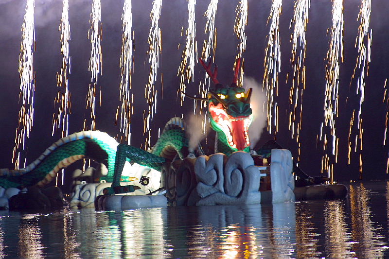
- Lake Numazawa Festival — Ken · CC BY-SA 3.0 · source · resized
- Lake Numazawa, Kanayamatown, Fukushima Prefecture — 黒ゆり · CC BY-SA 3.0 · source · resized
- Lake Numazawa, Fukushima prefecture 2008-06-13 (4694986813) — contri from Yonezawa-Shi, Yamagata, Japan · CC BY-SA 2.0 · source · resized
- Lake Numazawa 01 — Σ64 · CC BY 3.0 · source · resized
- Lake Numazawa 03 — Σ64 · CC BY 3.0 · source · resized
- Lake Numazawa 02 — Σ64 · CC BY 3.0 · source · resized
What this place is
Numazawa is a caldera and lake in Ōnuma District of Fukushima Prefecture, Japan. The caldera measures 2 km (1.2 mi) across and the lake that occupies it measures 96 m (315 ft) deep. The volcanic caldera was constructed within the older and larger Uwaigusa caldera which is 4.2 to 4.0 million years old. The volcano first erupted 110,000 years before present (BP) produced pyroclastics. At 71,000 BP, the Mukuresawa lava dome formed, and at 45,000 BP, a Plinian eruption occurred. Two additional lava domes developed in 43,000 BP and 20,000 BP. The caldera-forming Plinian eruption occurred at 4,600 BP. A VEI 5 eruption occurred at 3,400 BP.
Background text from Wikipedia (CC BY-SA 4.0)
What to expect at this type of place: Lakes & falls
Getting there
We do not have step-by-step transit directions for this spot yet. Open the location on Google Maps for routes from where you are staying.
Traveler reviews
No reviews yet — be the first to share how it went.