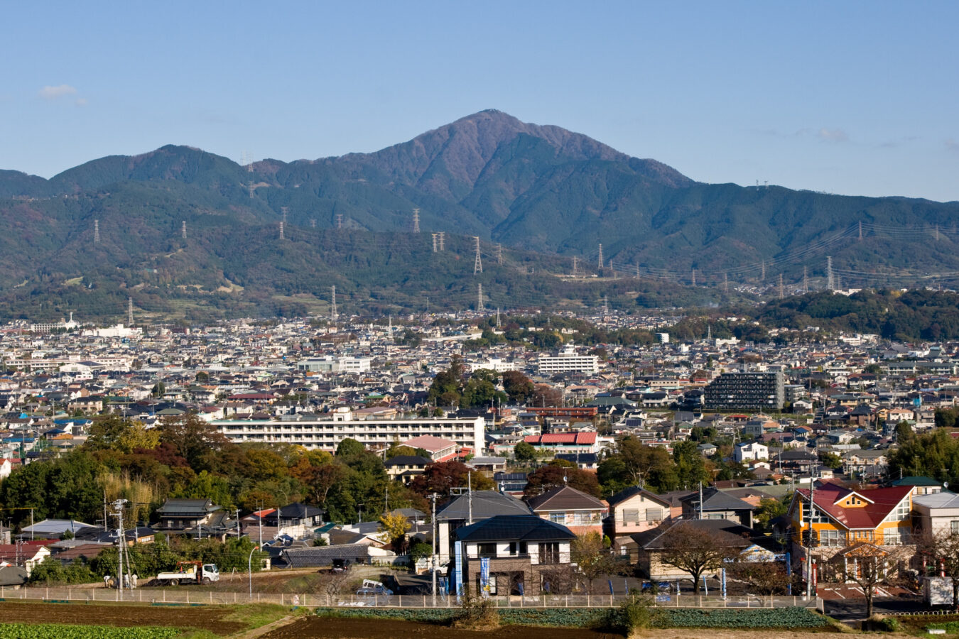
Mount Ōyama (Kanagawa)
大山 (神奈川県)
Opening hours and admission for this place have not been checked yet, so none are shown. Check the official site
Our guide
Mount Ōyama, also called Mount Afuri or Mount Kunimi, is a mountain 1,252 m high on the border of Isehara, Hadano and Atsugi in Kanagawa. With Mount Tanzawa and other peaks of the Tanzawa Mountains it forms Tanzawa-Ōyama Quasi-National Park, and it is a popular sightseeing spot in the prefecture.
Afuri-jinja Station is about 1.2 km from the point this page is mapped to. We have not checked routes to the summit or conditions, so check local information and the weather before you go.
Written by japan-spots.com (2026-09-22) from the sources credited on this page. Distances are straight lines between map positions.
Photos
Photos from Wikimedia Commons, each under its own licence — see credits
- Mt.Oyama from Shibusawa Hill Range 01 — Σ64 · CC BY 3.0 · source · resized
- 大山登拝門(片開き) — 小池 隆 · CC BY 4.0 · source · resized
- 大山登拝門(両開き) — 小池 隆 · CC BY 4.0 · source · resized
- 大山山頂広場から伊勢原の眺め — Koda6029 · CC0 · source · resized
- 大山山頂の雨降木 — Koda6029 · CC0 · source · resized
- Ōyama Aburi Shrine, Kanagawa, Japan - April 2008 — Σ64 · CC BY-SA 3.0 · source · resized
- Panorama of Ooyama — Pyzhou · GFDL · source · resized
- Mt.Oyama from Mt.Sannoto 01 — Σ64 · CC BY-SA 3.0 · source · resized
- Mt.Oyama from Mt.Ryugabanba — Σ64 · CC BY-SA 3.0 · source · resized
- Mt.Oyama from Mt.Komagatake 01 — Σ64 · CC BY-SA 3.0 · source · resized
What this place is
Mount Ōyama (大山, Ō-yama), also Mount Afuri (阿夫利山 or 雨降り山, Afuri-yama) or Mount Kunimi (Kunimi-yama), is a 1,252-metre-high (4,108 ft) mountain situated on the border of Isehara, Hadano and Atsugi in Kanagawa Prefecture, Japan. Together with Mount Tanzawa and other mountains in the Tanzawa Mountains it forms the Tanzawa-Ōyama Quasi-National Park. Mount Ōyama is a popular sightseeing spot in Kanagawa Prefecture.
Background text from Wikipedia (CC BY-SA 4.0)
What to expect at this type of place: Mountain
Nearby station
Nearby station: Afuri-jinja, about 1.2 km from the spot in a straight line.
Worked out on 2026-09-14 from this place’s map position, using HeartRails Express station data and station names from Wikidata. The distance is a straight line, not a walking route, and says nothing about buses, transfers or timetables — plan the trip on Google Maps.
Traveler reviews
No reviews yet — be the first to share how it went.