Usual hours and prices, checked 2026-10-06 against the sources under “What this place is”. They can change for holidays and events — confirm before you go. Official site
Our guide
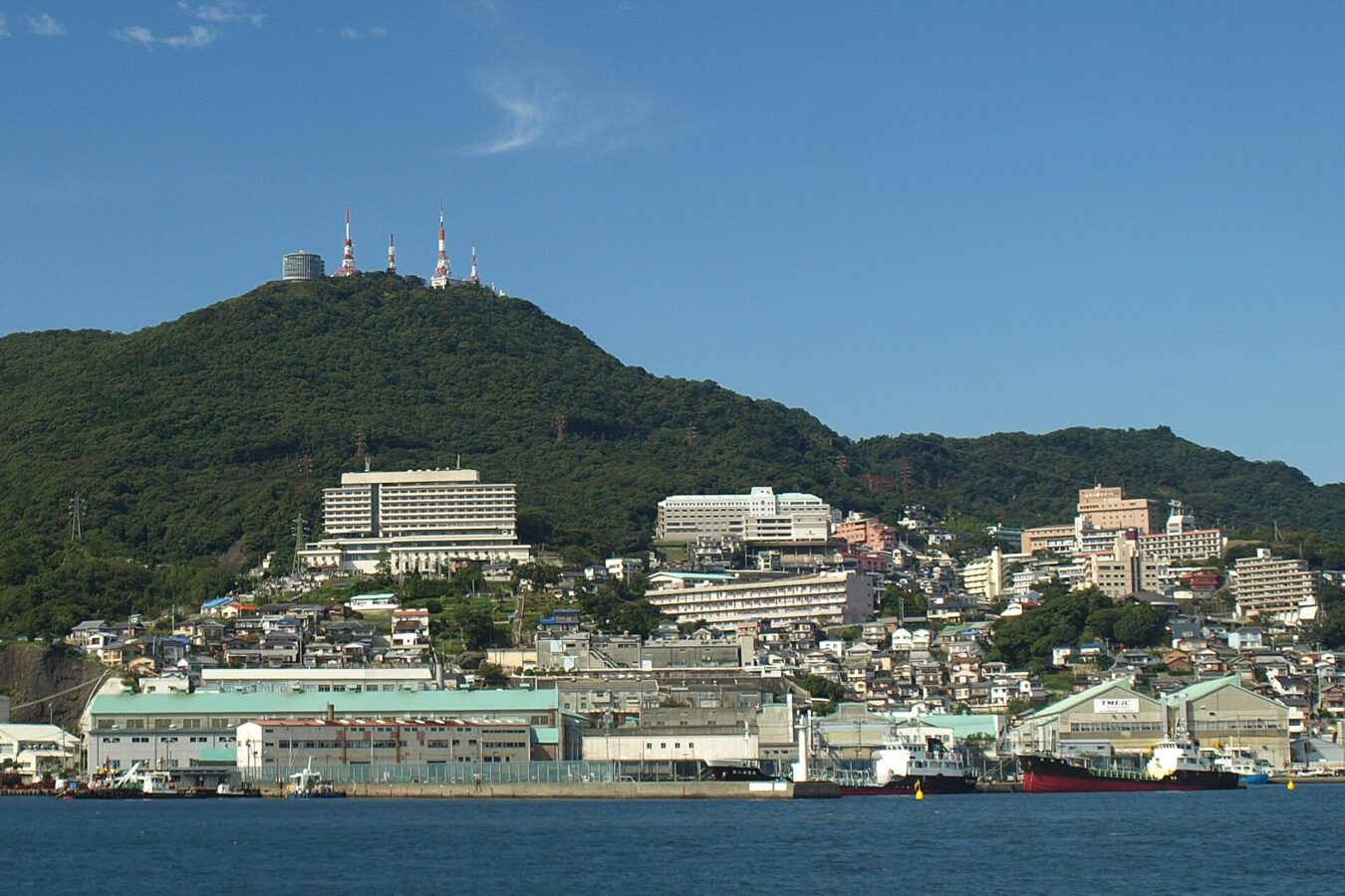
Mount Inasa is a hill of 333 m to the west of central Nagasaki. The Nagasaki Ropeway and the Inasa slope car make it easy to reach the top, where a short walk from their adjacent stations leads to the Mt. Inasa Overlook, a multi-level observation deck with a 360-degree view from the roof and a restaurant on its lower level.
The night view is the reason to come. The panorama from here is known as Nagasaki's “ten-million-dollar night view”, and in 2021 Nagasaki's night view was certified as one of the “World's New Three Great Night Views” by the Night View Summit.
We have not checked the ropeway's hours or fares, or the route to its lower station, so look for local information before you go.
Written by japan-spots.com (2026-09-22) from the sources credited on this page. Distances are straight lines between map positions.
Photos
Photos from Wikimedia Commons, each under its own licence — see credits
- Mt.Inasa 2010 — ぱちょぴ · CC BY-SA 3.0 · source · resized
- View from Mt.Inasa 01 — Σ64 · CC BY 3.0 · source · resized
- Mt.inasa Ropeway passageway blue — R34SkylineGT-R V-SpecⅡNür · CC BY-SA 3.0 · source · resized
- Mt.inasa Ropeway passageway Rainbow — R34SkylineGT-R V-SpecⅡNür · CC BY-SA 3.0 · source · resized
- Mt. Inasa slope car of inside — ブルーノ・プラス · CC BY-SA 4.0 · source · resized
- Mt. Inasa slope car — ブルーノ・プラス · CC BY-SA 4.0 · source · resized
- Mt.Inasa Ropeway — ブルーノ・プラス · CC BY-SA 4.0 · source · resized
- Mount Inasa Top Square 20220707 — Marine-Blue · CC BY-SA 4.0 · source · resized
- Mount Inasa Summit 20220803 — Marine-Blue · CC BY-SA 4.0 · source · resized
- Mount Inasa Slope car Summit Station 20220707 — Marine-Blue · CC BY-SA 4.0 · source · resized
What this place is
Mount Inasa (稲佐山, Inasa-yama) is a hill to the west of Nagasaki which rises to a height of 333 metres (1,093 ft). The Nagasaki Ropeway and the Nagasaki Inasa Mountain Slope Car (in Japanese) allow visitors to easily travel to the summit.A short walk from the top ropeway and slope car stations (adjacent to each other) is Mt. Inasa Overlook, a multi-level observation deck with "360-degree panoramic view" from the rooftop. Nagasaki's night view was certified as one of the "World's New Three Great Night Views" by the Night View Summit held in 2021, organized by the Night View Tourism Convention Bureau. The panoramic night view from Mt. Inasa is known as Nagasaki's "10 Million Dollar Night View" (1000万ドルの夜景, Issenmandoru no yakei). In the lower level of the observation deck there is a restaurant Mount Inasa Restaurant ITADAKI.
Visitor information checked: 2026-10-06 · Inasayama Park: observatory
Background text from Wikipedia (CC BY-SA 4.0)
What to expect at this type of place: Mountain
Nearby station
Nearby station: STADIUM CITY NORTH, about 1.8 km from the spot in a straight line.
Worked out on 2026-09-14 from this place’s map position, using HeartRails Express station data and station names from Wikidata. The distance is a straight line, not a walking route, and says nothing about buses, transfers or timetables — plan the trip on Google Maps.
Traveler reviews
No reviews yet — be the first to share how it went.