此景點的開放時間與費用尚未確認,因此不顯示。 請至官方網站確認
編輯部導覽
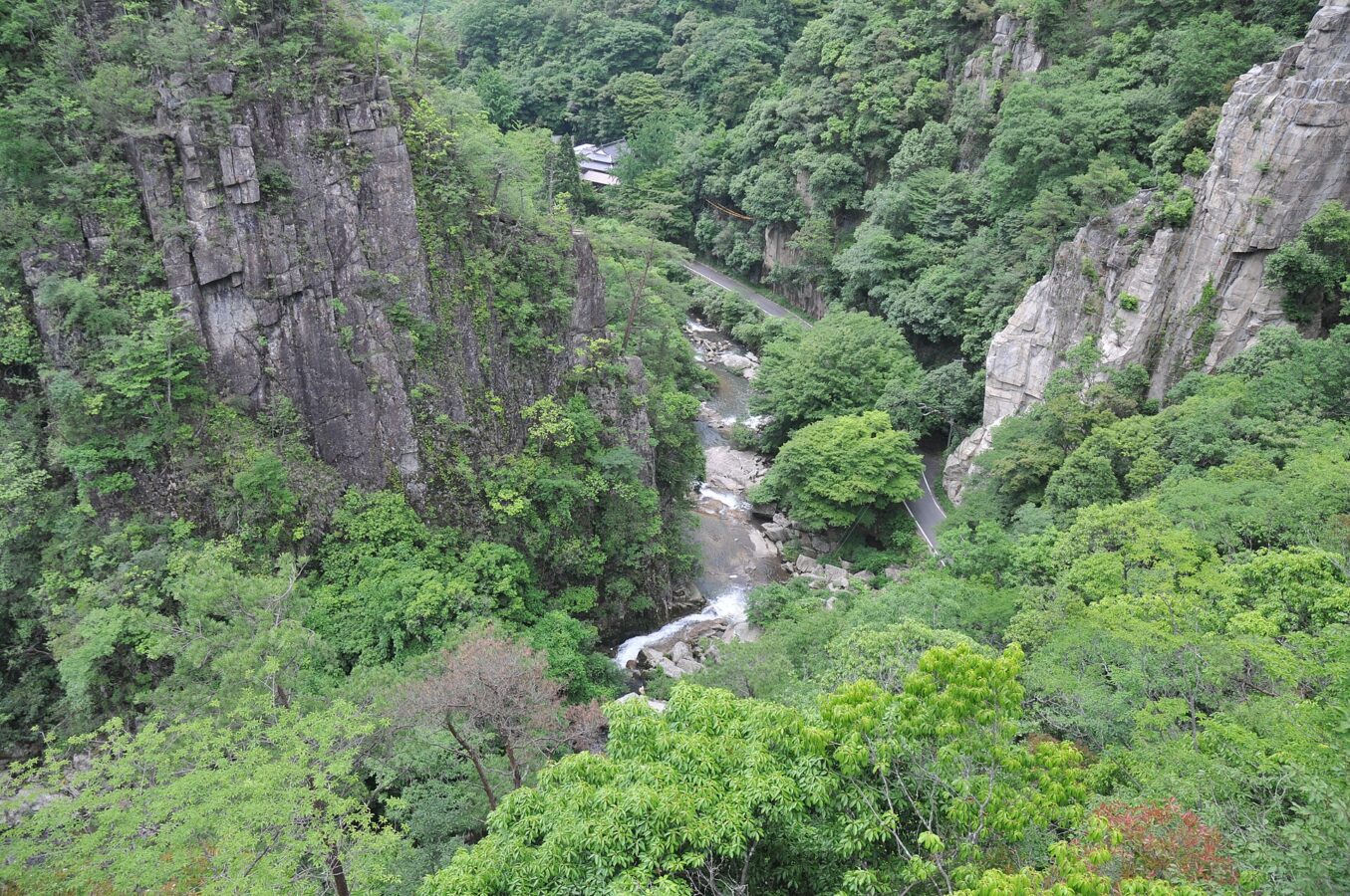
豪溪是高梁川支流 Makidani 川形成的溪谷,從岡山縣總社市最北端延伸到吉備中央町(舊賀陽町)。溪谷全長只有約 600 公尺,卻布滿風雨侵蝕而成的奇特花崗岩,1923 年被指定為國家名勝。知名景點包括高 330 公尺的岩峰、天柱山、劍峰與雲梯山。
根據我們的資料,可經岡山縣道 57 號(總社賀陽線)前往;大眾運輸我們並未確認。
japan-spots.com 編輯部撰寫(2026-09-22),依據本頁標示的來源。距離為地圖上的直線距離。
照片
照片取自 Wikimedia Commons,各依其授權條款使用——查看出處
- Gokei 04 — Reggaeman · CC BY-SA 3.0 · 來源 · 已調整尺寸
- Goukei 19 — Reggaeman · CC BY-SA 3.0 · 來源 · 已調整尺寸
- Goukei 18 — Reggaeman · CC BY-SA 3.0 · 來源 · 已調整尺寸
- Goukei 12 — Reggaeman · CC BY-SA 3.0 · 來源 · 已調整尺寸
- Goukei 07 — Reggaeman · CC BY-SA 3.0 · 來源 · 已調整尺寸
- Gokei 02 — Reggaeman · CC BY-SA 3.0 · 來源 · 已調整尺寸
- Goukei 11 — Reggaeman · CC BY-SA 3.0 · 來源 · 已調整尺寸
- Gokei 03 — Reggaeman · CC BY-SA 3.0 · 來源 · 已調整尺寸
- Gokei 01 — Reggaeman · CC BY-SA 3.0 · 來源 · 已調整尺寸
這是什麼樣的地方
豪溪是由高梁川支流槙谷川形成的河谷,從日本岡山縣總社市最北端延伸至吉備中央町(舊加茂川町)。全長僅約600公尺,卻布滿經風雨侵蝕而成的奇特花崗岩,吸引許多人前來欣賞,1923年被指定為國家名勝。著名景點包括高330公尺的岩峰、天柱山、劍峰與雲梯山,可經岡山縣道57號(總社賀陽線)前往。
說明文字譯自: 英文維基百科 (CC BY-SA 4.0)
交通方式
本站尚未提供此景點的大眾運輸路線說明。請在 Google 地圖上查看從您所在位置出發的路線。
旅客口碑
尚無口碑,來寫第一則吧!